Innovation Project • Archaeology Safety

Temple Tunnel Rover

Our wooden rover uses camera-based observation and mapping to explore tight, fragile spaces and support VR experiences.

Phase 1

Identify — core problems

Quick summary and visual evidence from our early research, site visits, and reading.

Brainstorm Site visit Mentors

Quick takeaways

Site visits
Documentaries
Team voting
  • We studied preservation methods at the MET.
  • We watched excavation documentaries to spot real‑world risks.
  • We voted to focus on the highest‑impact safety problem.

Research photos

Two visuals that summarize our early research.

Click images to enlarge. Replace filenames with your photos if needed.
Phase 1 • Diverging

Research themes brainstormed

Main challenges we compared.

Final focus after voting

Expert interview summary - Grace Howe

We are presenting: Field challenges + key site

Visuals to support the Identify + Research story: risky environments and the Temple of the Feathered Serpent.

Dark cave passage
Narrow cave passage
“Robots can explore places that are too risky for people.”
Identify + Research — Isabella
Caves and ancient temples are dark, narrow, unstable, and hard to reach. Mapping them safely protects fragile structures and preserves history.
Temple of the Feathered Serpent
Sergio Gómez Chávez
“Our problem is how to safely explore and map narrow and unstable underground spaces.”
Identify — Julisa
The Temple of the Feathered Serpent has underground tunnels unsafe for human exploration, sharpening our focus on safe mapping.

Problem statement

Archaeologists must explore fragile, narrow temple tunnels and caves, but human entry is unsafe and can damage artifacts. Existing tools are too large or disruptive, so a compact, low‑impact rover is needed to safely map and document these spaces.

We are presenting: Design timeline

A vertical timeline showing how each person contributed to the process.

Week 1 — Launch + research
We kicked off the project, defined the problem, and collected early research from site visits, documentaries, and mentor feedback.
Week 2 — Cardboard mock
Owen focused on the cardboard model because he is the youngest, and it was the best way to learn the basics of sizing and layout.
Week 3 — LEGO model
The LEGO model was led by a first‑year FLL participant to build confidence with the platform and learn the core build skills.
Weeks 4–6 — CAD design
Isabella handled the CAD work because she was learning CAD at school and could apply those skills to the rover parts.
Weeks 7–9 — Programming
Jonathan led programming because he was the most experienced, but everyone helped with programming to share the work and learn together.
Weeks 10–14 — Testing + iteration
We tested movement, sensors, and durability, then refined parts and code based on feedback and trial runs.
Weeks 15–18 — Final prep
Final integration, presentation polish, and practice runs leading into the Feb 22nd competition.
Weeks 19+ — Wooden rover + camera mapping
After competition, we built a wooden rover version and transitioned from distance-sensor-heavy testing to camera-based observation and mapping.
Progress tracker
Research
Complete
Cardboard
Complete
LEGO build
Complete
CAD parts
Complete
Programming
Complete

We are presenting: Goals tracker

A simple spreadsheet-style view of who owned each goal.

Owner Goal Deadline Status Evidence Next step
Owen Cardboard mock sizing, wheelbase, and component placement 09/14/2025 Complete 
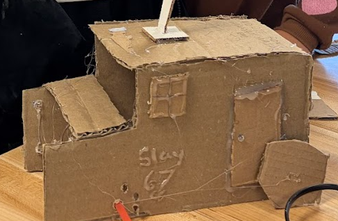
Cardboard models photo; tunnel clearance check Compare against LEGO chassis size
Owen 
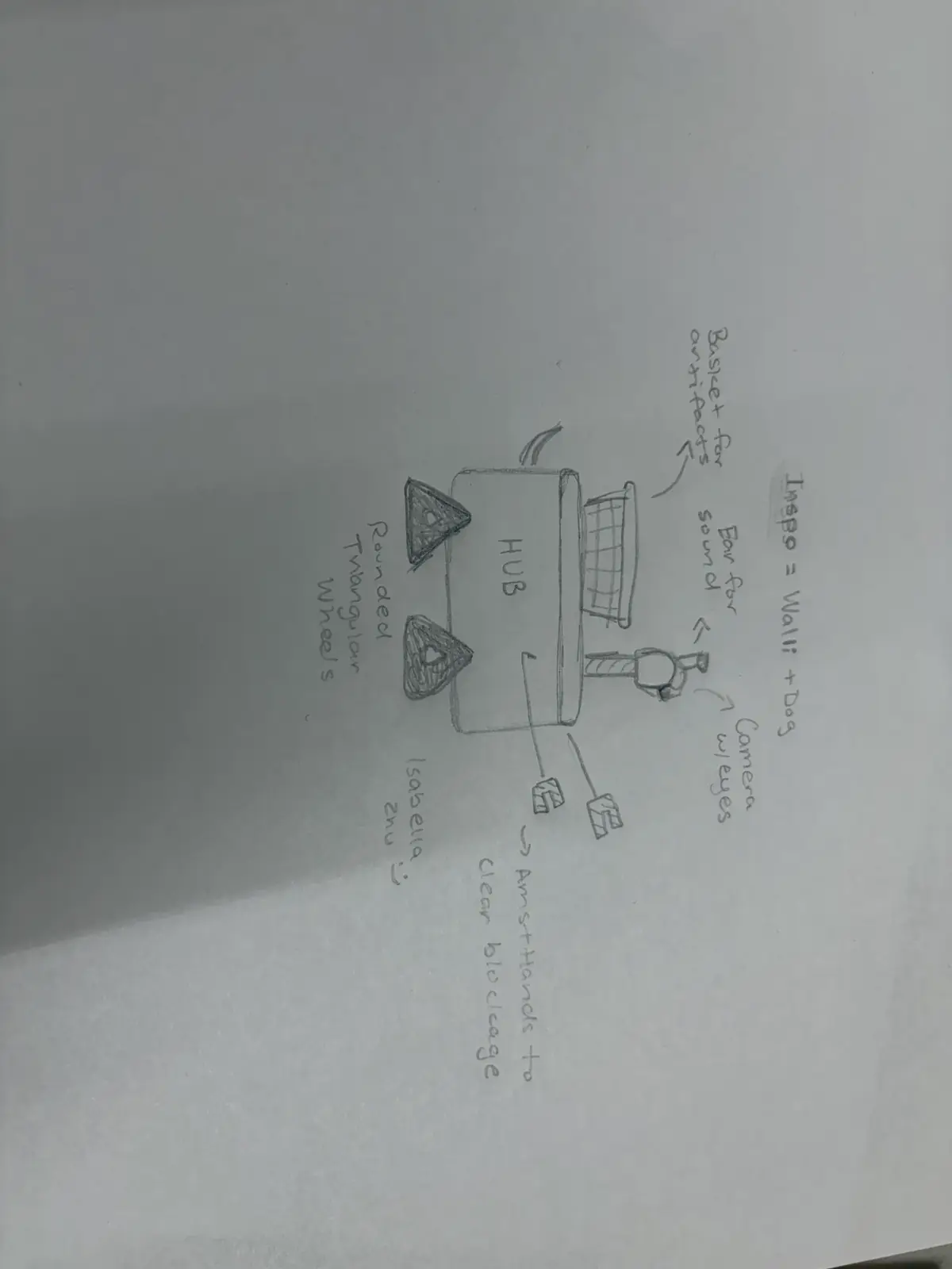
Component layout map (motors, hub, sensors) 09/21/2025 Complete Placement sketch + photos Confirm cable routing paths
First‑year FLL participant 
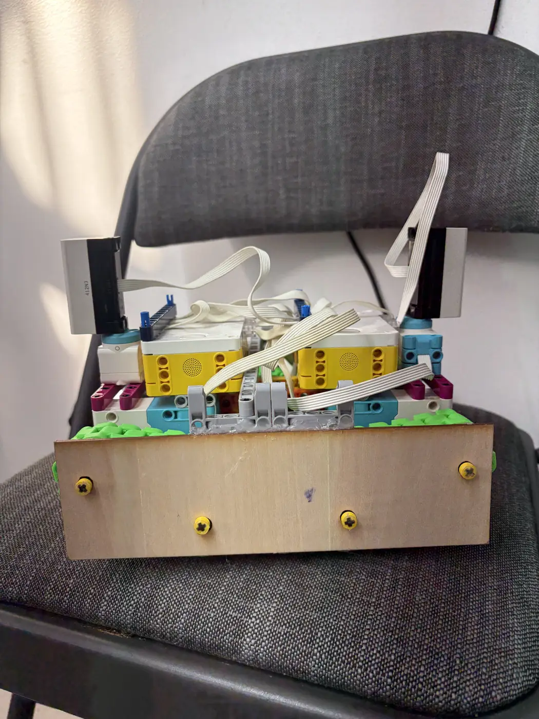
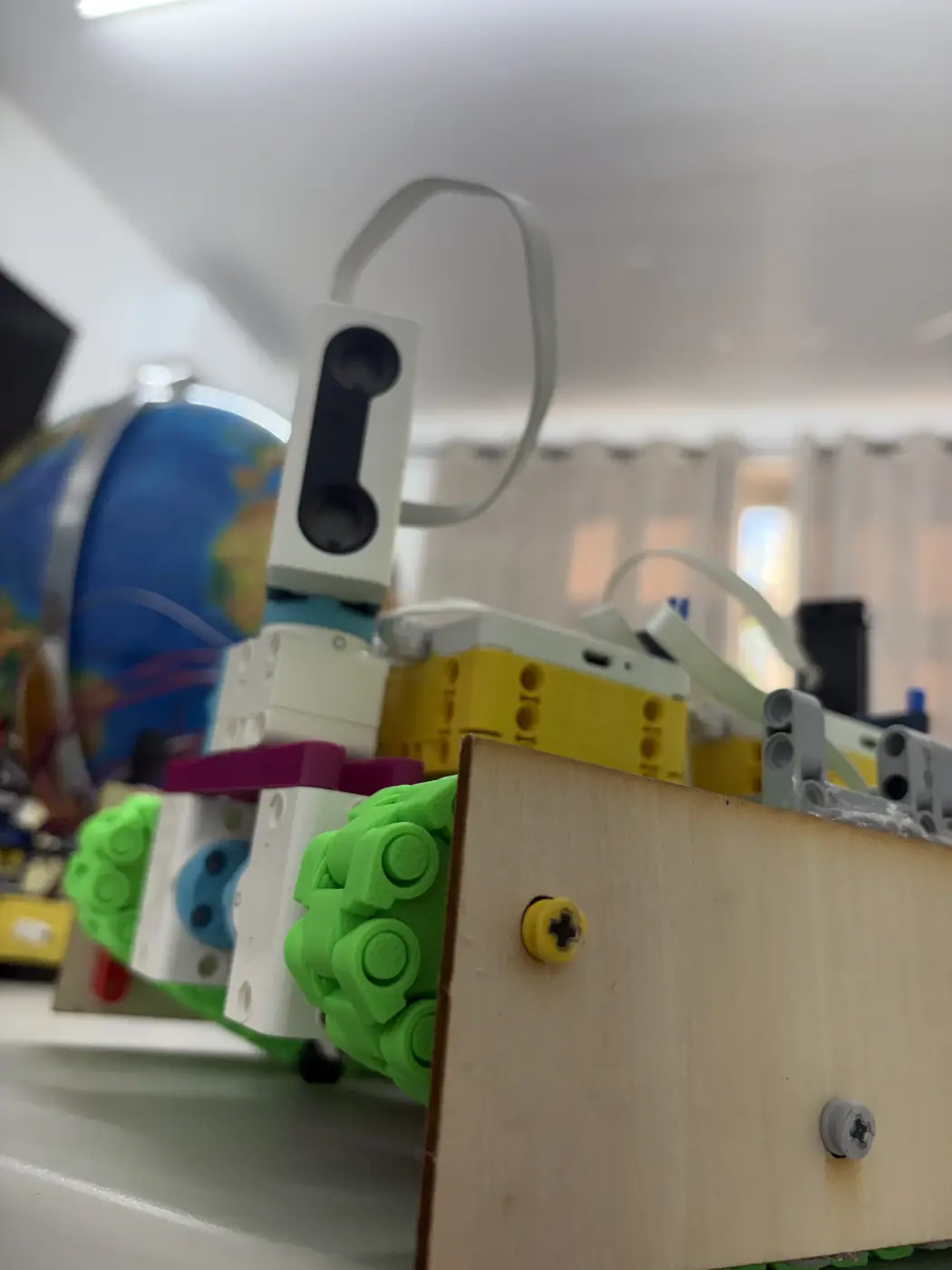
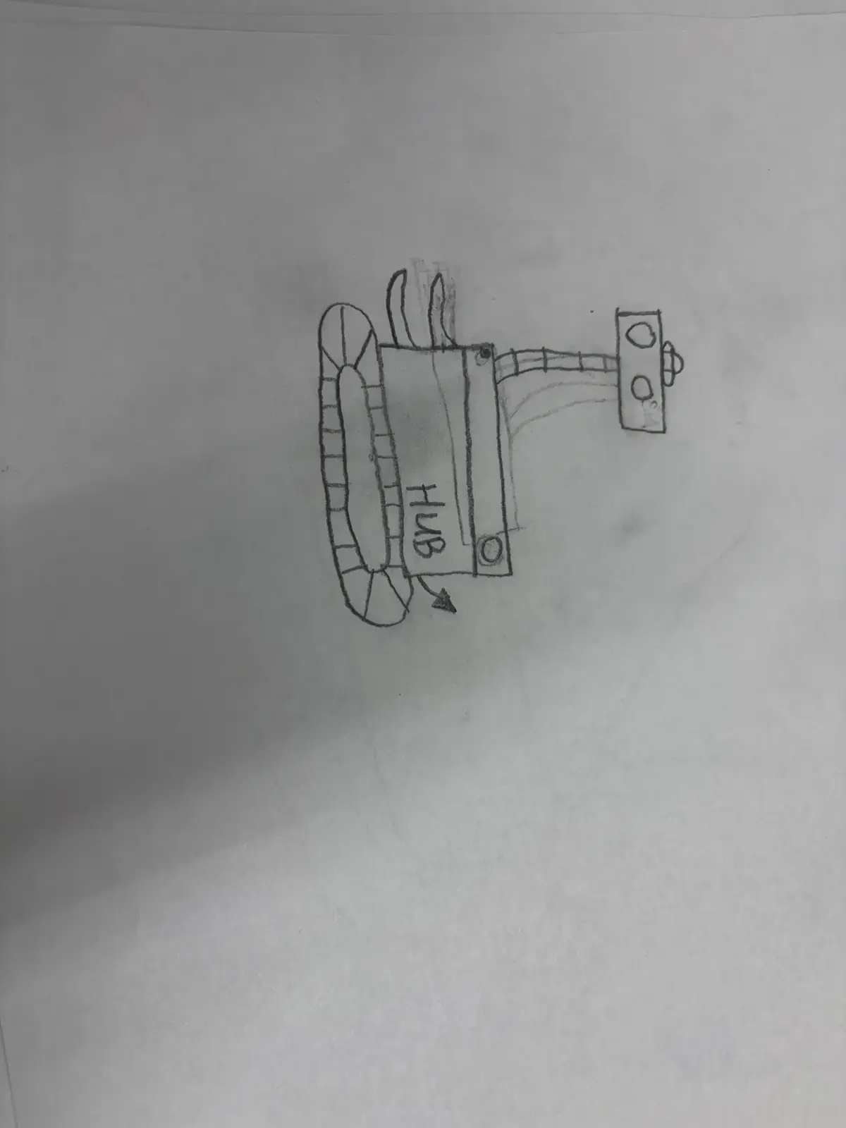
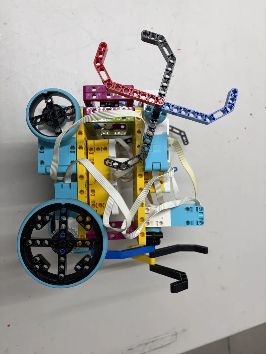
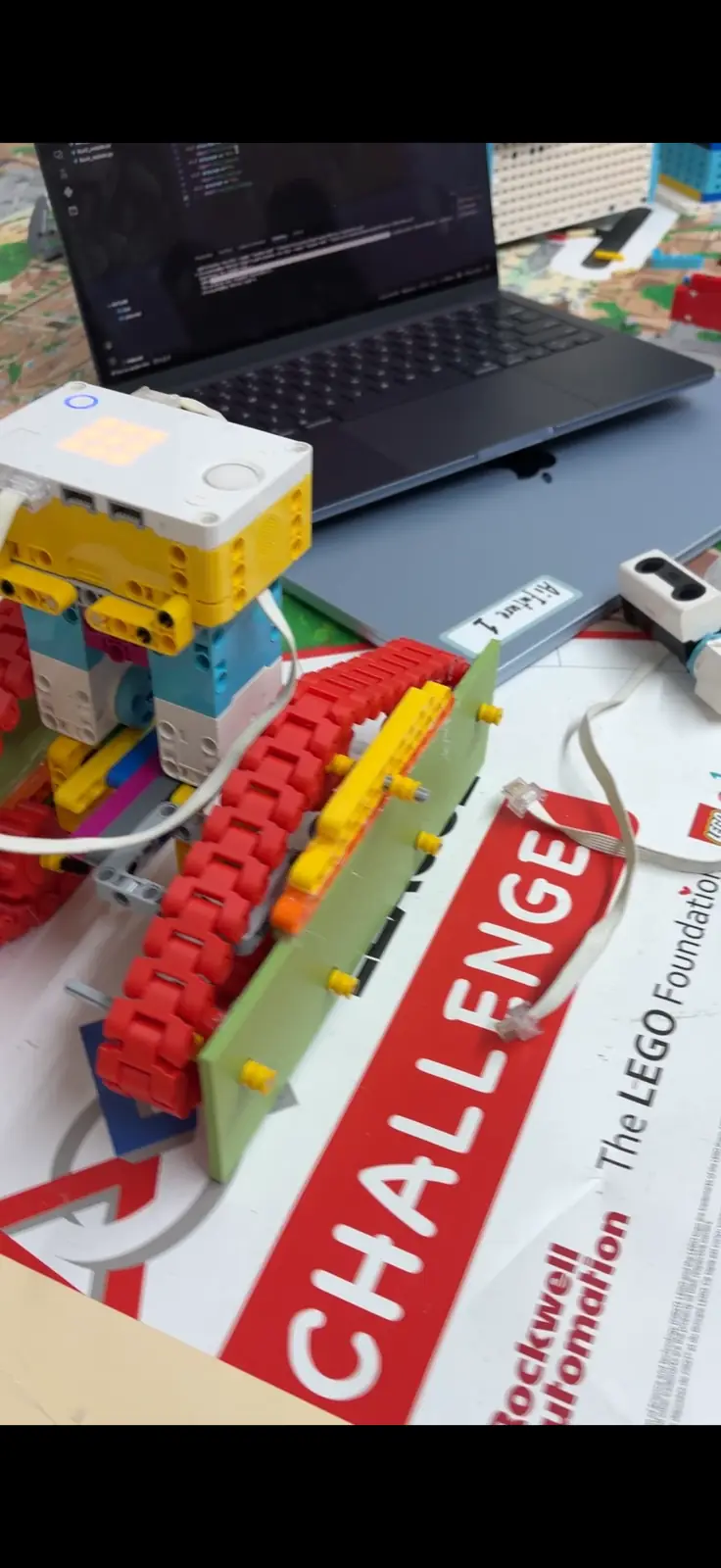
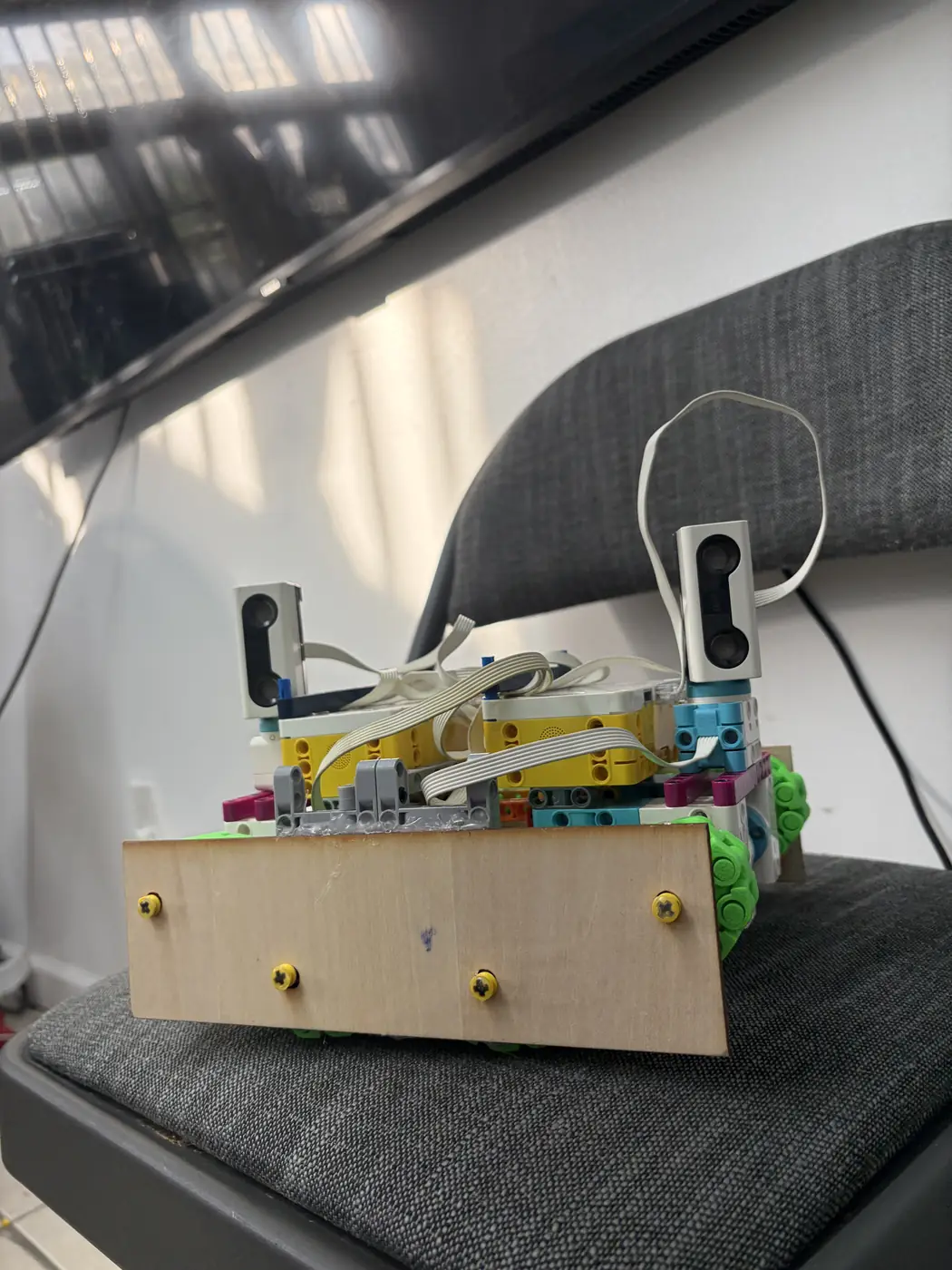
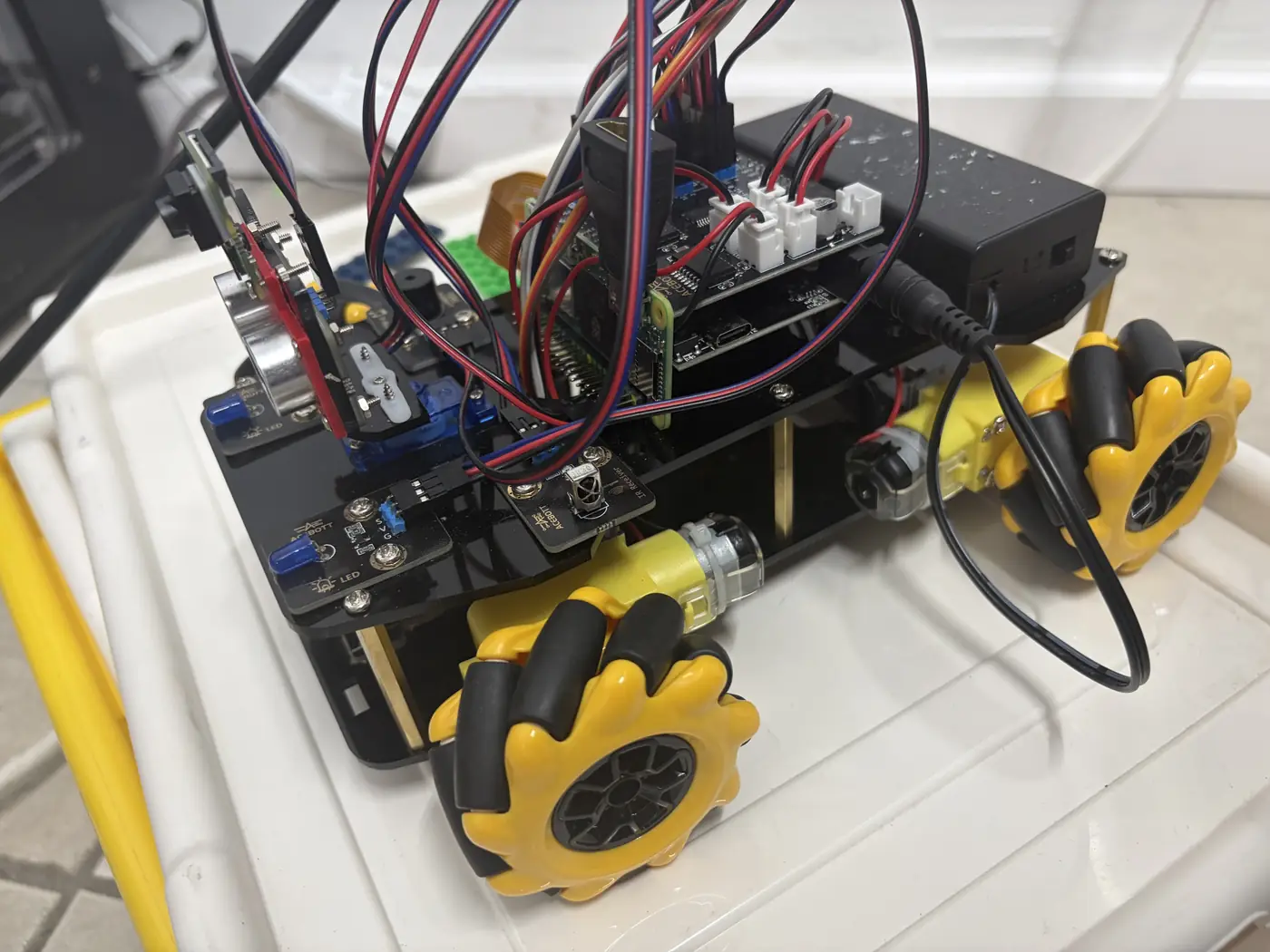
LEGO drivetrain assembly + stability baseline 09/28/2025 Complete LEGO prototype photos; short movement trial Adjust bumper height and wheel clearance
First‑year FLL participant 
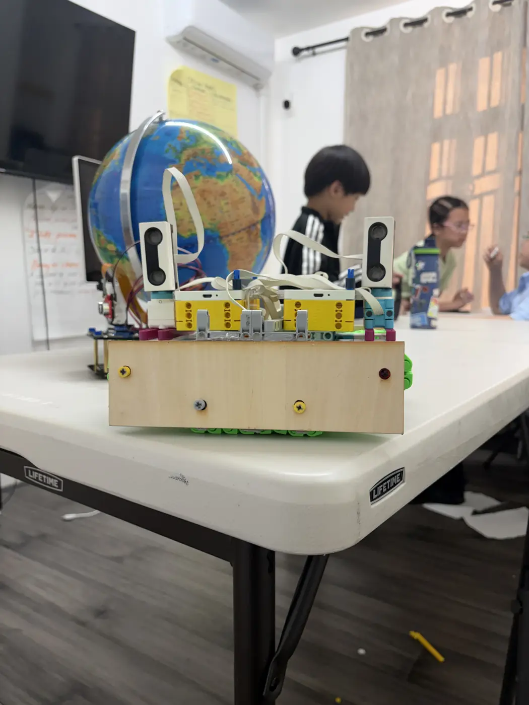
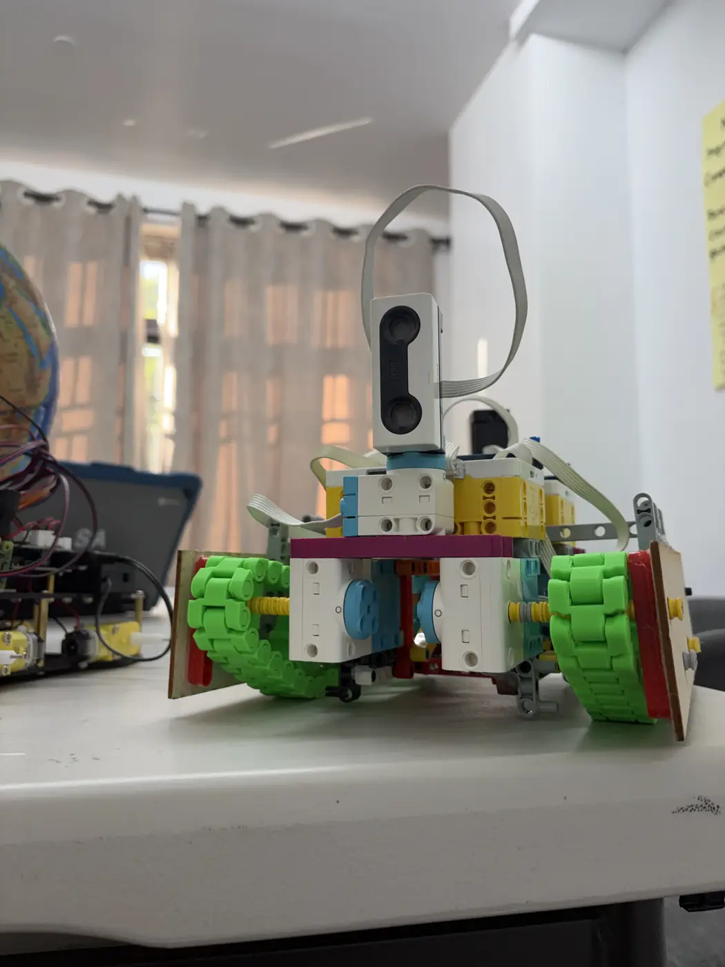
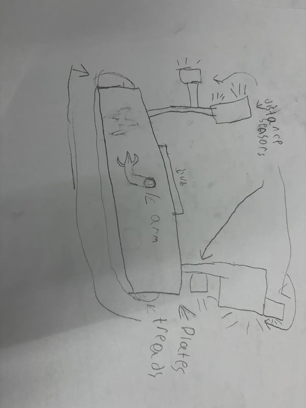
Rebuild for tighter turning radius 10/05/2025 Complete Photo + notes on turning test Share changes with CAD team
Isabella 
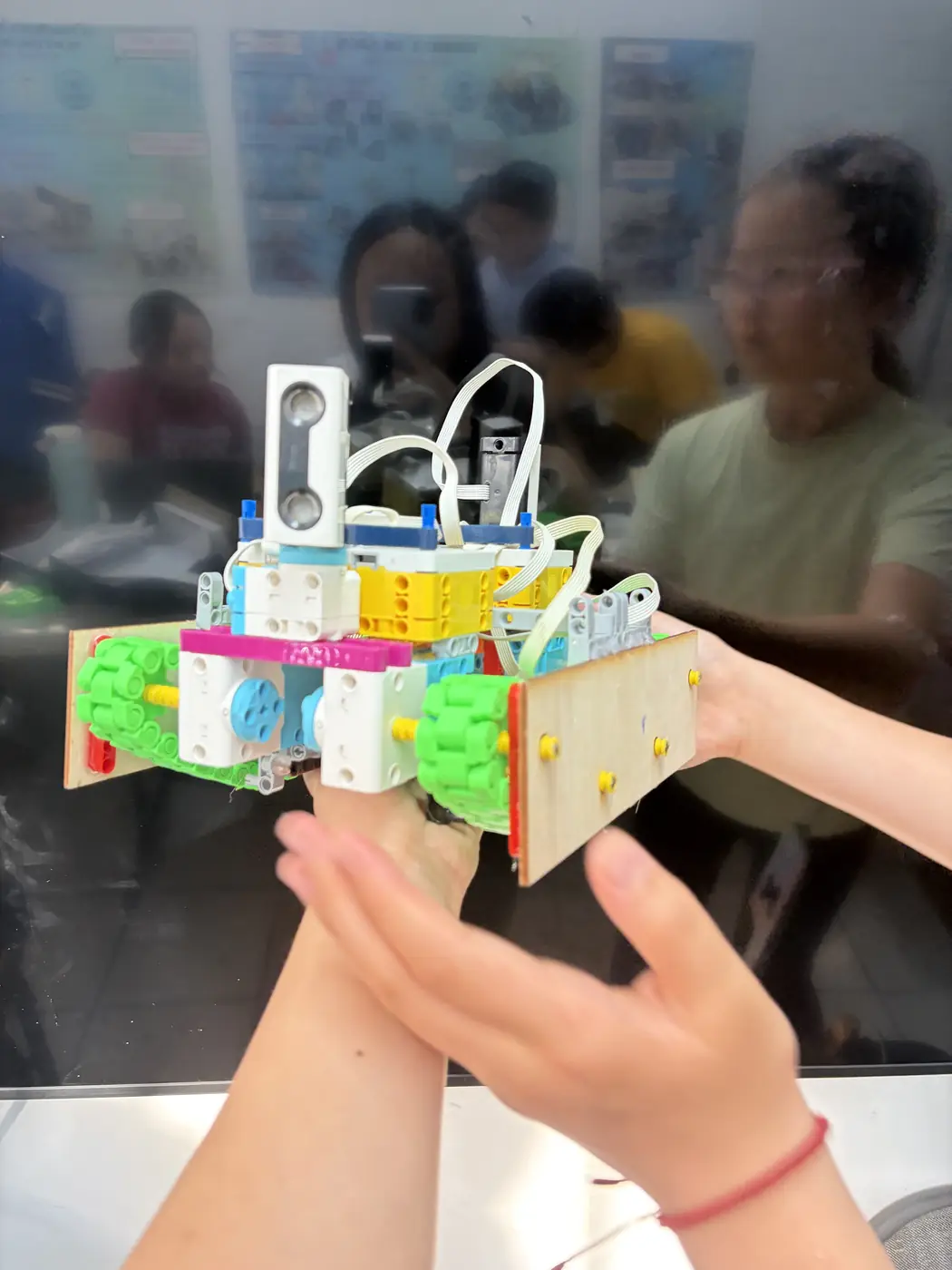
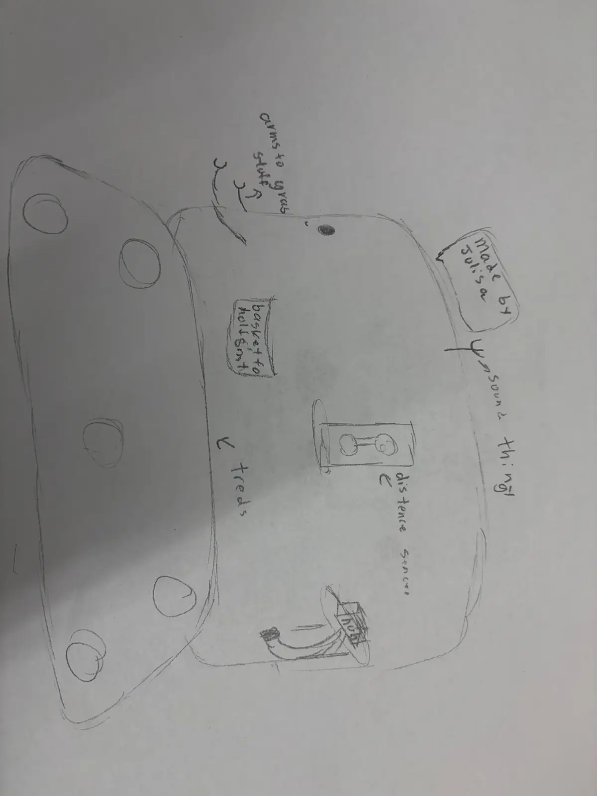
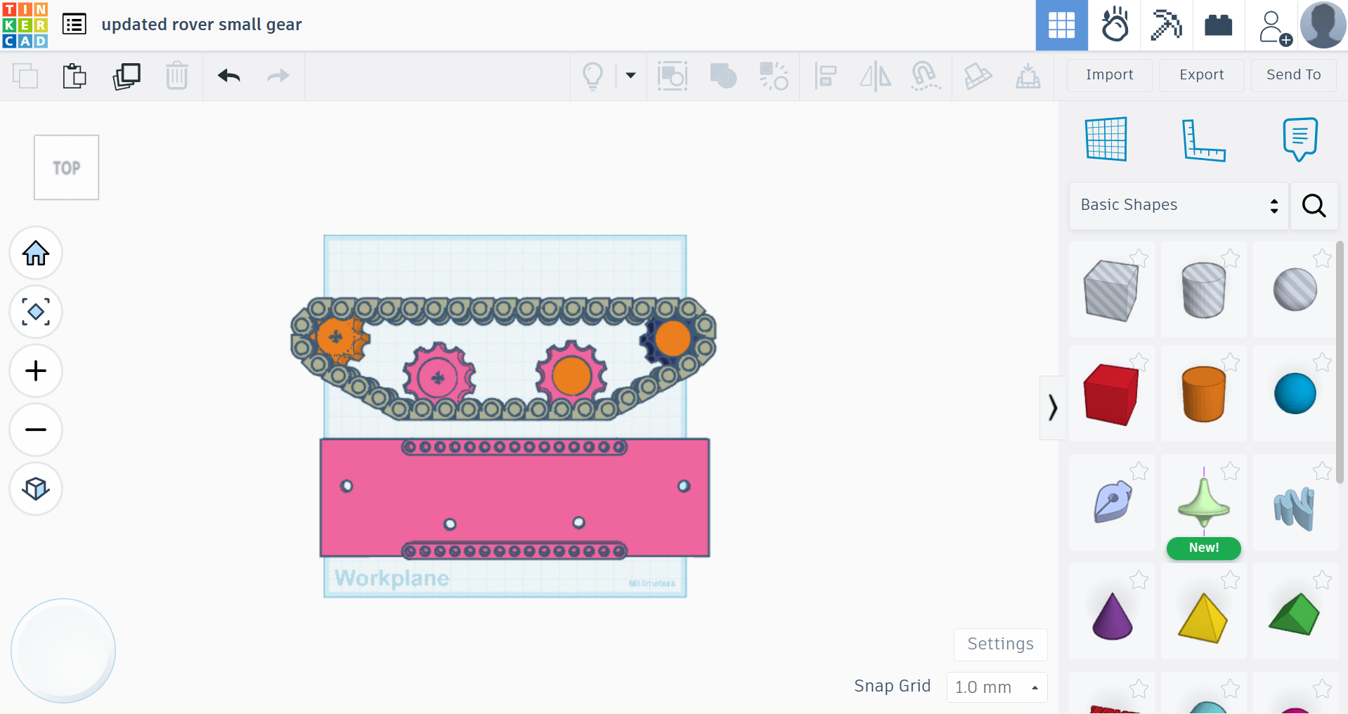
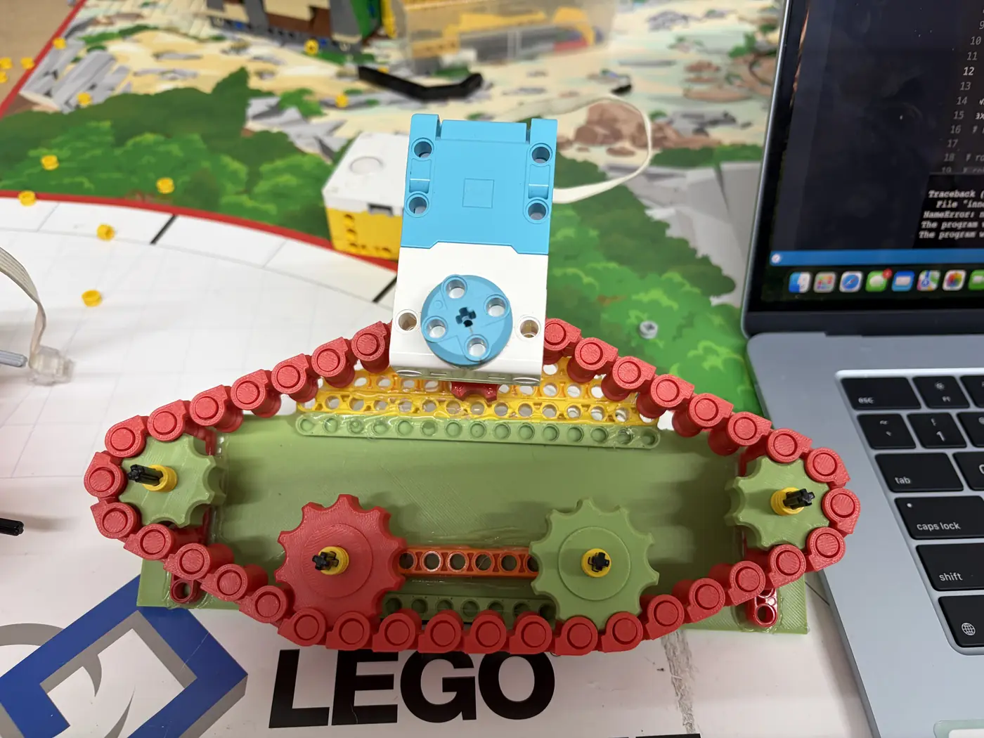
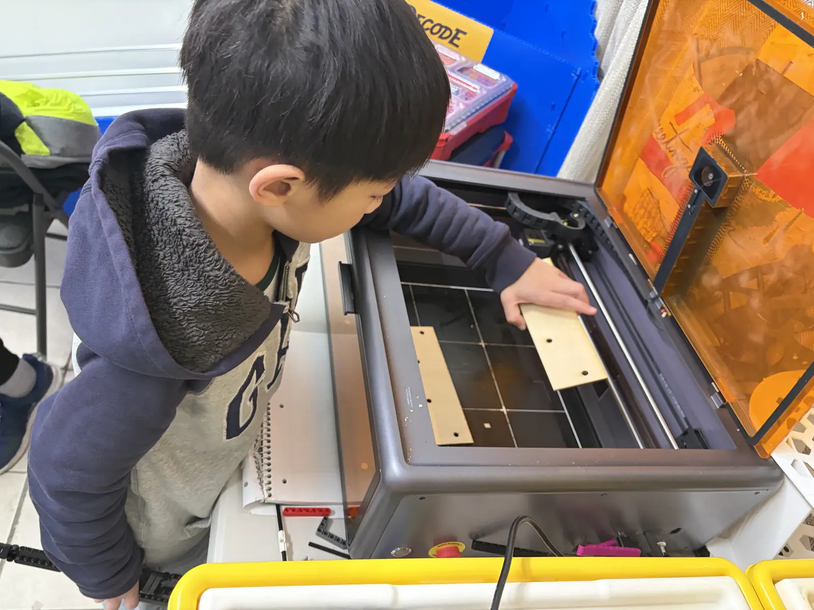
CAD: tread design + mounting brackets 10/12/2025 Complete Tinkercad screenshots; print preview Print test piece for fit
Isabella 
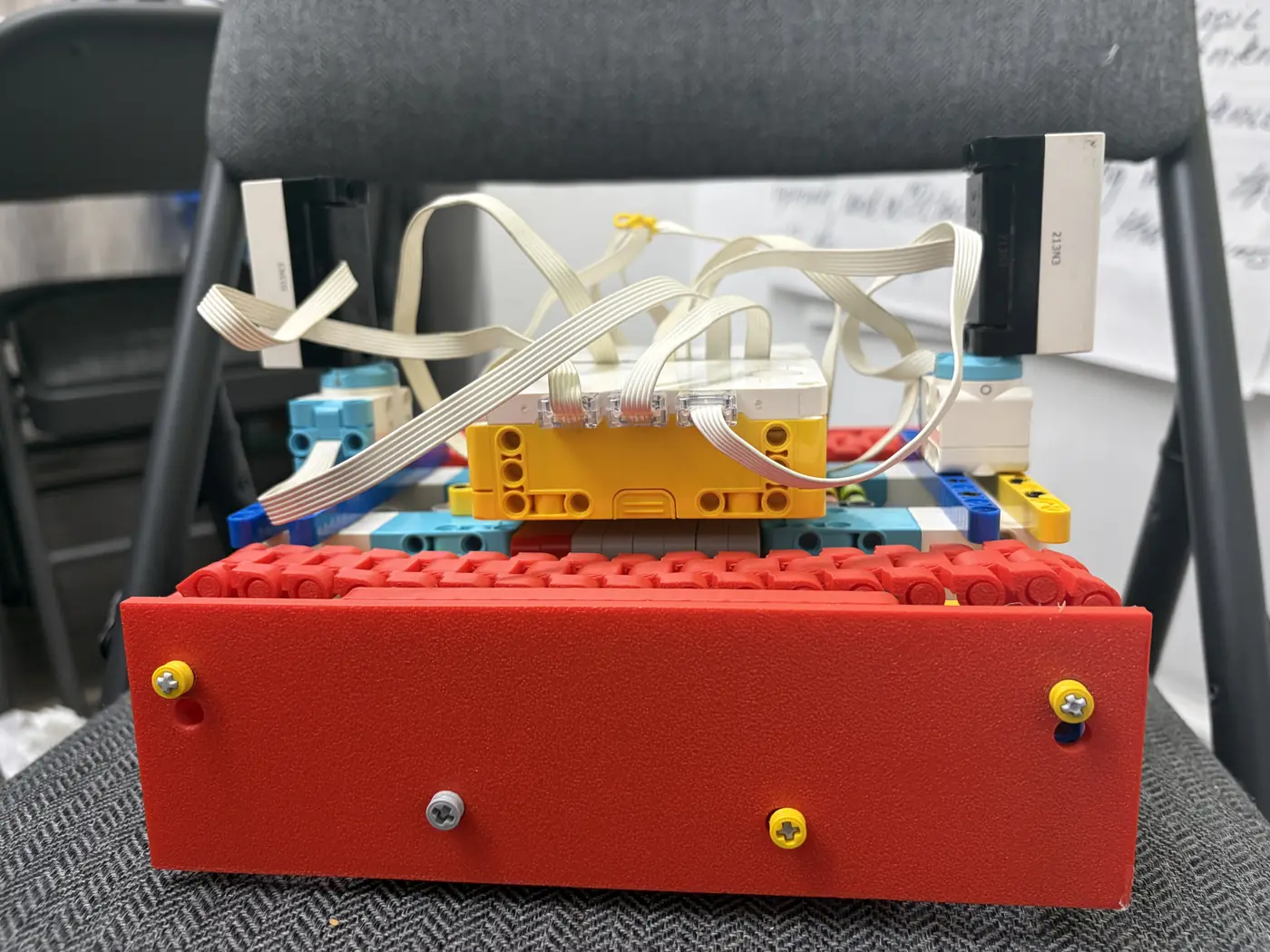
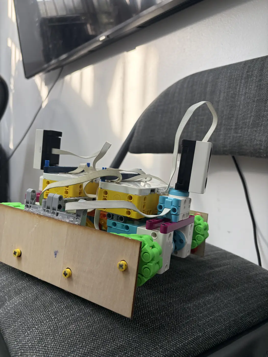
CAD: protective plate + sensor mount revisions 10/26/2025 Complete Fit check photos; mounting notes Finalize print settings
Jonathan 
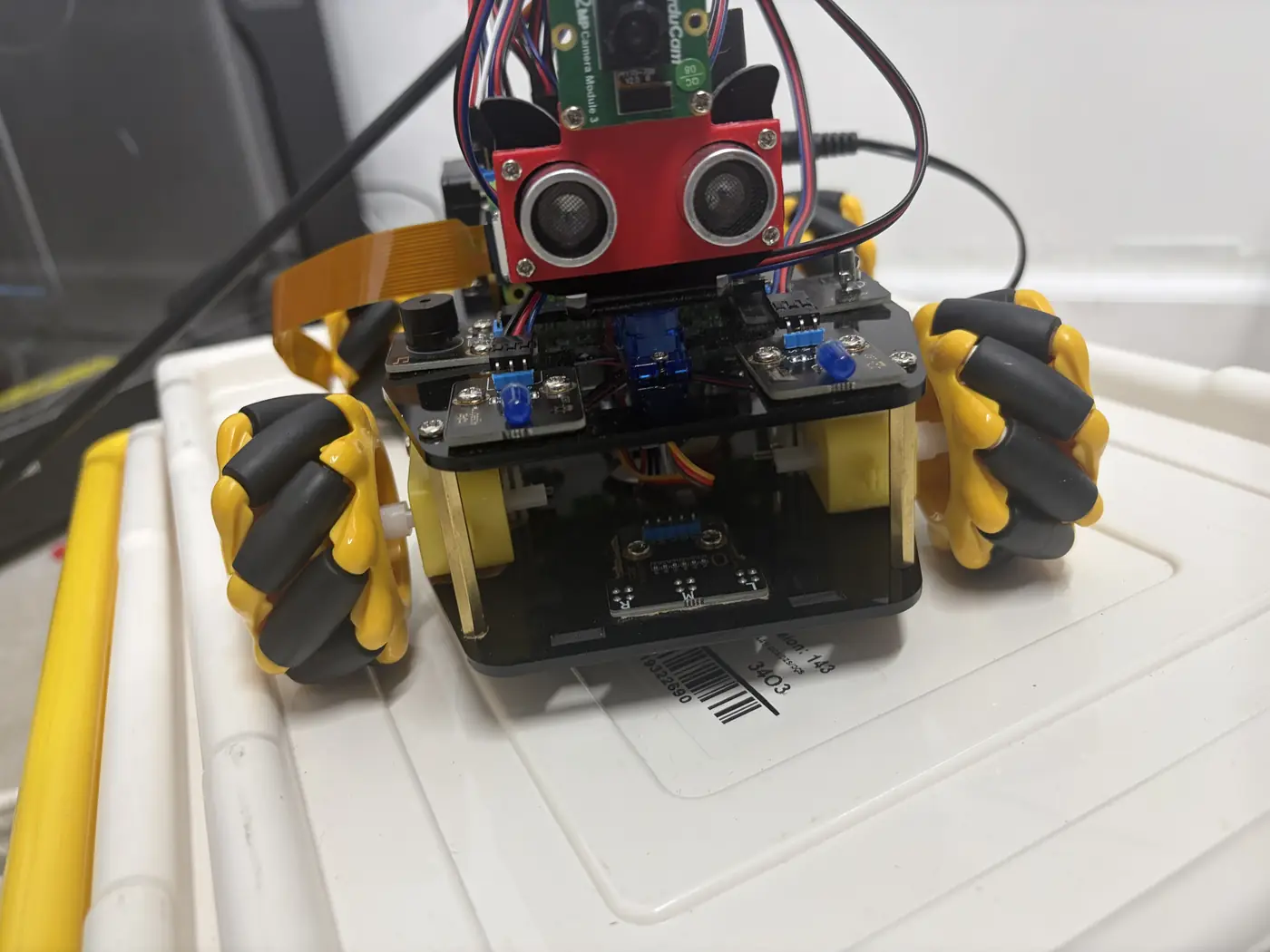
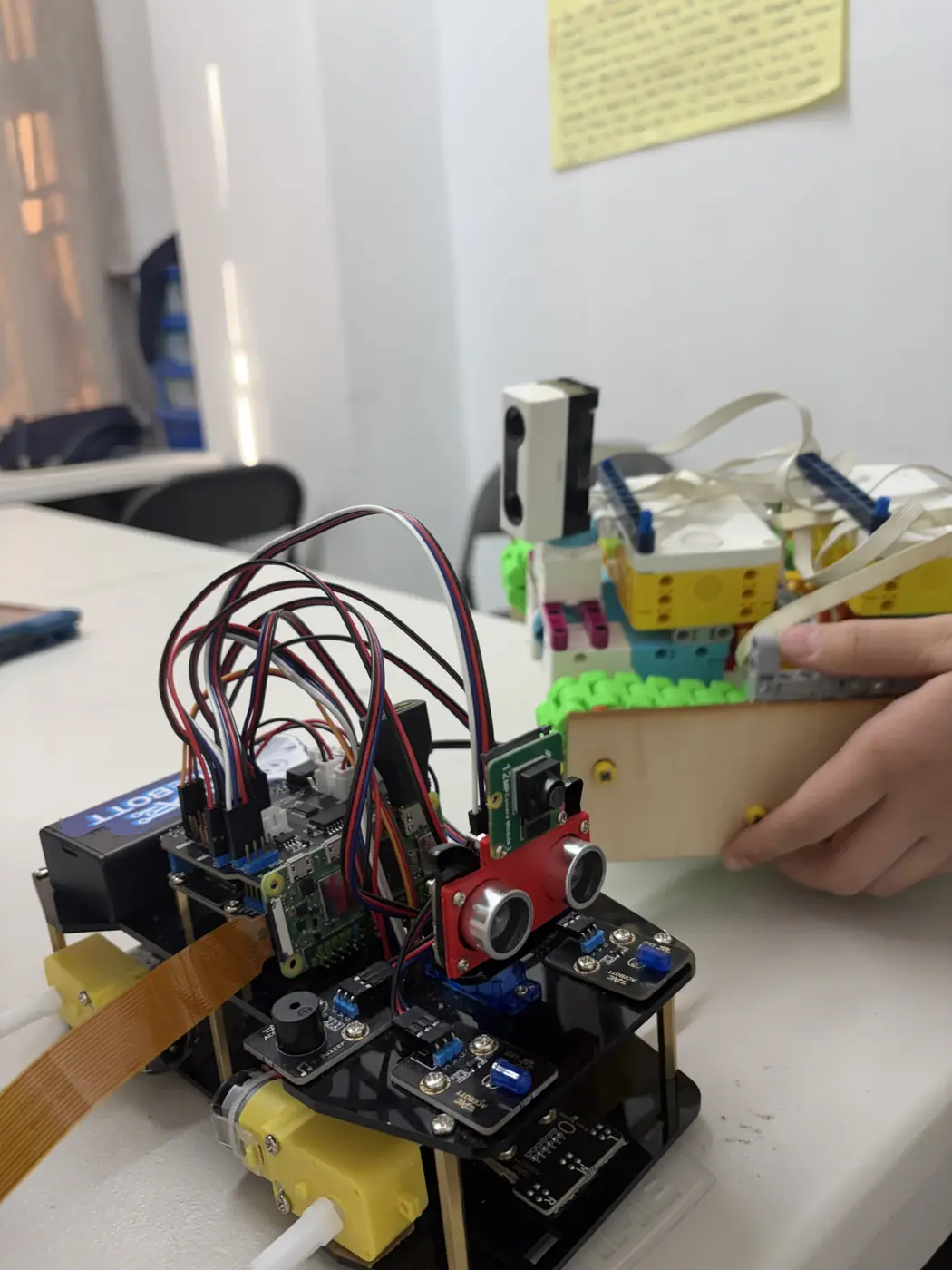
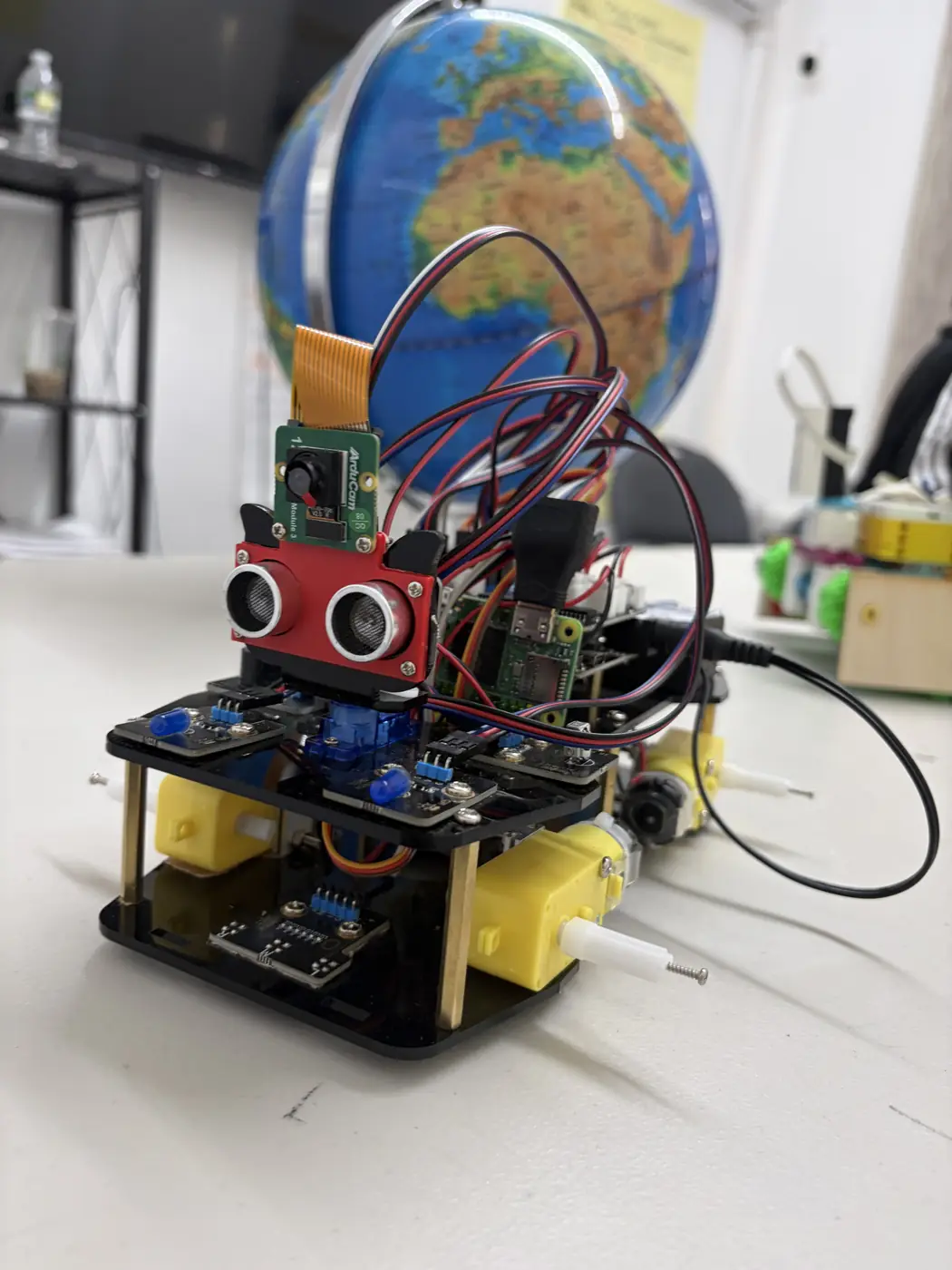
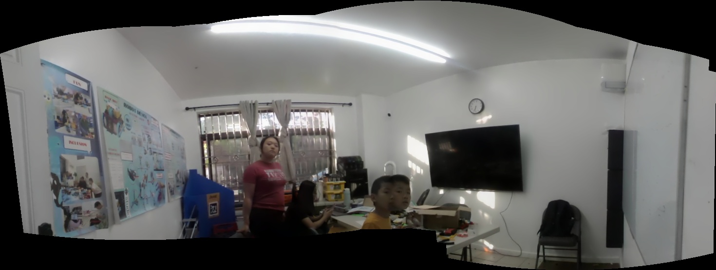
Programming: camera frame processing + obstacle logic 11/09/2025 Complete Code screenshots; camera hallway test log Tune low-light exposure and frame rate
Jonathan 
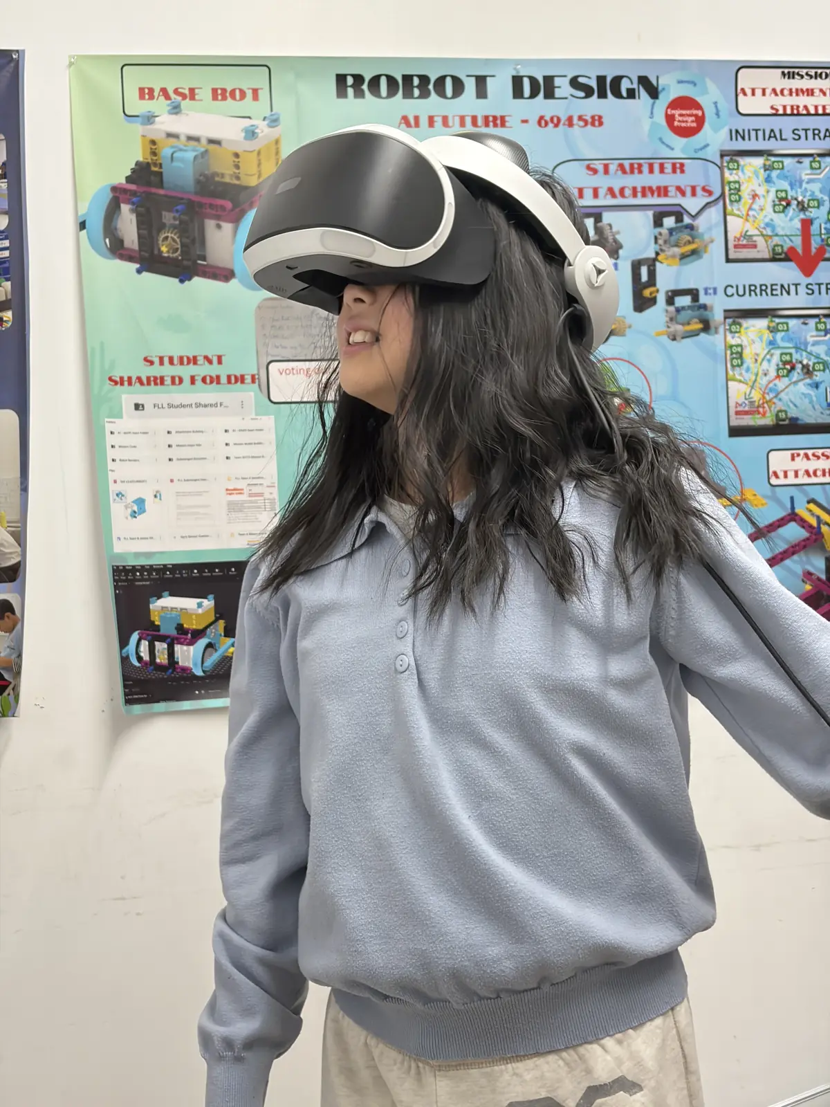
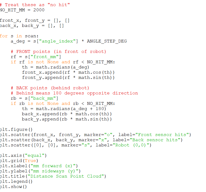
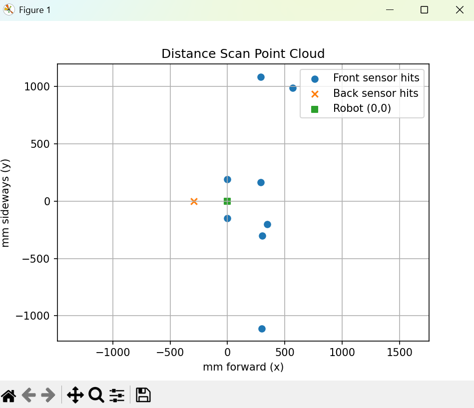
Programming: map logging for VR pipeline 11/23/2025 Complete Sample map exports + test run Integrate export format with VR viewer
Team 
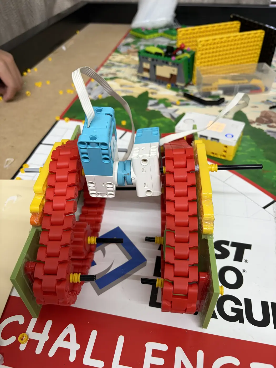
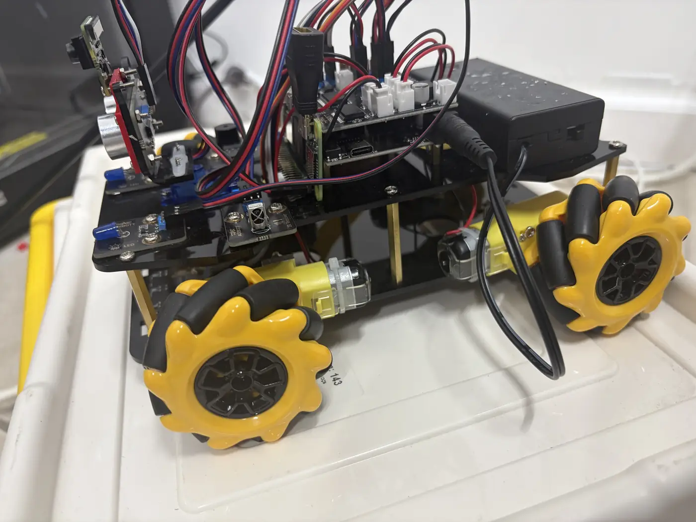
Testing: terrain traction + tread durability 12/07/2025 In progress Rover test GIFs + wear notes Adjust tread thickness
Team 
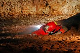
Testing: camera mapping + blind-spot checks 12/21/2025 Complete Camera mapping runs + blind-spot test notes 
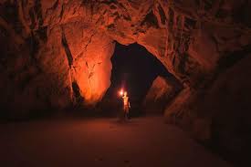
Improve capture quality in dark tunnels
Team Presentation: storyboard + demo script 01/05/2026 Planned Slides outline + demo checklist Add timing and transitions
Team Judging practice + final polish 01/19/2026 Planned Q&A list + rehearsal notes Run full demo rehearsal
This shows how everyone had a meaningful part of the process.
Phase 2

Research — what we compared

A quick look at common inspection tools and why they fall short in fragile, narrow tunnels.

Market scan Pros/cons At-a-glance

Human exploration

Human exploration in narrow sites

Archaeologists enter with protective gear and lights to study artifacts up close.

High risk Close access
  • Pros: Direct observation and detailed study.
  • Cons: Tight spaces, poor air, unstable tunnels; human movement can damage fragile walls/artifacts.

Large robots & scanners

Large robots or scanning machines

Large robotic platforms and scanning machines collect data without direct human entry.

Data collection Too large
  • Pros: Helpful scans and measurements.
  • Cons: Often too big for narrow tunnels, hard to transport to remote sites, and vibrations can damage fragile areas.

Underwater archaeology robots

Underwater archaeology robot

Specialized robots used underwater (like the one Grace Howe shared).

Safer access Not for tunnels
  • Pros: Improves safety compared to human entry.
  • Cons: Expensive, complex, and built for underwater environments — not tight, fragile tunnels or caves.

We are presenting: Key gap we found

Current solutions either put people at risk or use large, expensive tools that don’t fit narrow, fragile tunnels — leaving a clear gap for a small, low‑impact rover.

Tether risk High vibration Limited mapping Easy deploy
Solution goals

We are presenting: Clear targets before we designed

These were the outcomes we aimed for to guide planning and brainstorming.

Low-cost Low-impact Narrow-fit

We are presenting: Project goals infographic

Low-cost rover
Affordable parts and simple build
Safe navigation
Sense obstacles in tight tunnels
Low-impact design
Protect fragile spaces
Capture + share
Record data for VR

These goals set our direction before planning and brainstorming.

We are presenting: Why VR matters

VR lets people explore ancient spaces from the rover’s perspective — without traveling, without entering danger, and without risking damage.

IMAGE PLACEHOLDER
Replace with: VR headset view / museum exhibit mockup / “rover POV” screenshot.
Benefit
Access
Explore sites from anywhere
Benefit
Preservation
Reduce human impact on fragile areas
Phase 3

We are presenting: Design — planning the rover

We used IDEO’s 7 rules to brainstorm, sketch, compare tradeoffs, and organize responsibilities.

IDEO rules Sketching Timeline

We are presenting: IDEO brainstorming rules

🎯 Stay focused on the topic
😄 Encourage wild ideas
⚡ Go for quantity
🗣️ One conversation at a time
🚫 Defer judgment
🎨 Be visual
🔗 Build on the ideas of others
Short, playful rules kept the team creative and fast.

We are presenting: Sketches collage

Replace with your full sketch collage and drawing photos.
Phase 4

We are presenting: Create, iterate, communicate

Timeline of builds, feedback, and upgrades.

Cardboard mock LEGO prototype 3D printed treads Sensor placement

We are presenting: Build timeline

Create, Iterate, Communicate — Julissa

With a plan in place, we moved into the create phase and began building multiple versions of our rover. Our first model was made from cardboard so we could quickly visualize the size, layout, and placement of components before building with LEGO. After that, we built fully LEGO-based prototypes to test movement, stability, motor placement, structure, and cable management.

Create, Iterate, Communicate — Isabella

We reached out to science and technology teachers for feedback. They noted SPIKE Prime wheels struggle on uneven terrain. We researched treads, designed custom ones in Tinkercad, and 3D‑printed them. We also designed a protective plate to shield the treads in rough environments.

Teacher feedback collage (4 photos)
Create, Iterate, Communicate — Julissa

After creating our 3D‑printed parts, we reached out to Grace Howe again. She stressed reducing blind spots and capturing what archaeologists actually need to see. We first tested multiple distance sensors, then developed camera-based observation and mapping logic. Our rover now maps with camera data, so we no longer rely on distance sensors as the primary mapping method.

Create, Iterate, Communicate — Jonathan + Team

We added a new full iteration cycle by building a wooden rover version, then refining camera mapping logic on that platform. This helped us test durability and mapping quality together in one workflow, instead of treating hardware and programming as separate steps.

Create
Built the wooden rover version for stronger protection and stability.
Iterate
Adjusted camera mapping logic using repeat runs in narrow-space tests.
Communicate
Shared progress with mentors and updated our innovation story with evidence.
Add images/videos from the “Rover Iterations” folder and replace placeholders with the exact filenames.
Phase 5

We are presenting: Programming — camera observation + mapping logic

We tested multiple approaches and now use camera observations to map surroundings in tight spaces with better context.

Repeated testing Reliability Camera logic

We are presenting: Programming highlights

  • Camera-first logic: observe surroundings, classify open space/obstacles, then move
  • Distance sensors are now used only for early calibration checks
  • We log camera observations and map updates for debugging and VR prep

These visuals show our early baseline before we shifted to camera-based mapping.

What's next

We are presenting: Current status + next improvements

We completed a wooden rover version and camera-based mapping logic. Next we are improving low-light capture and turning map output into smoother VR walkthroughs.

Wooden build complete Camera mapping live VR mapping

We are presenting: Completed upgrades + next steps

  • Completed: moved to a wooden rover build for stronger protection in rough environments
  • Completed: developed camera logic to observe surroundings and map without relying on distance sensors
  • Next: improve low-light camera performance and stabilize map output for VR scenes

We are presenting: Why these updates matter

Our wooden rover increases durability while staying light. Camera-based mapping captures richer visual context than simple distance readings, and VR helps archaeologists and museums share discoveries safely.

🛡️ Stronger protection
Wooden structure is more durable in uneven and narrow spaces
📸 Better mapping
Camera logic adds visual detail and reduces dependence on distance-only readings
Phase 7 · What's Next

Future Visuals

A preview of our next-phase builds — precision laser-cut wood paneling and immersive VR archaeology walkthroughs powered by our camera mapping logic.

🔭 In Progress
Laser-cut wood panels for the rover
🪵 Laser-Cut Wood Build
Precision-cut panels for a stronger, lighter rover shell
UPCOMING
VR walkthrough of mapped tunnel
🥽 VR Walkthrough
Camera map data converted to an immersive temple experience
PLANNED
2
Next-phase builds
360°
VR coverage goal
Low‑light
Camera upgrade next

We are presenting: Closing summary

This project protects people and history. We now have a wooden rover and camera-based mapping logic, and we are continuing to improve map quality for immersive VR exploration.